
A New Tool for Maine: Four Counties Now Live in the Maine Zoning Atlas
The Maine Zoning Atlas has published zoning data for York, Cumberland, Sagadahoc, and Washington counties.
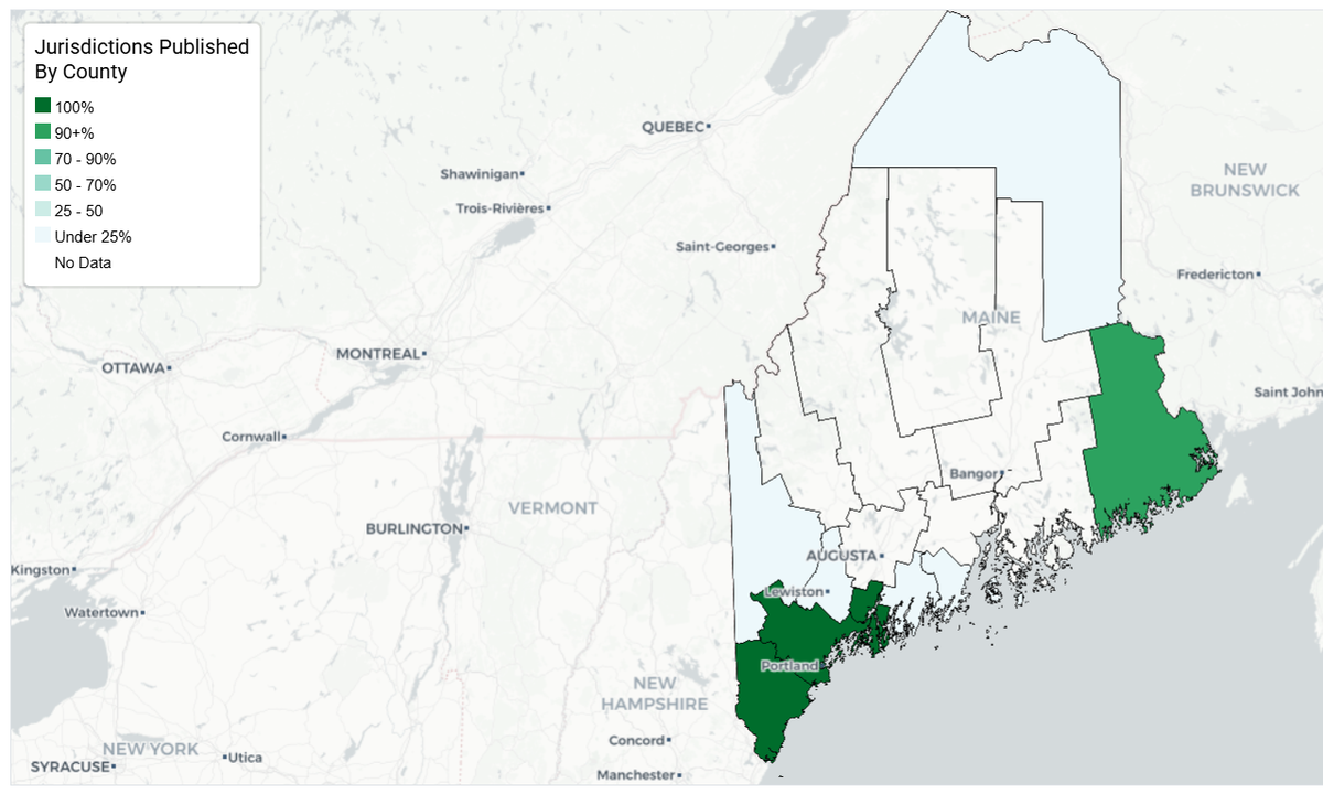
Maine now has a powerful new resource to understand and shape its land use future: the Maine Zoning Atlas has officially published zoning data for York, Cumberland, Sagadahoc, and Washington counties. This milestone, supported by GrowSmart Maine in its role as fiscal sponsor, marks the first time such a large share of the state’s zoning regulations can be viewed, compared, and analyzed in one place.
For a state where zoning exists in more than 400 municipal silos, the implications are enormous.
The Atlas offers something Maine has never had before, a clear, consistent, statewide picture of where different types of housing are actually allowed, and where they aren’t.
As communities try to respond to the housing shortage, prepare for demographic shifts, and plan for climate resilience, this tool brings needed transparency to a system that has long been difficult to interpret, even for experienced planners.
With four counties now online, municipal officials, planners, legislators, community groups, and residents can begin to answer questions that previously required hours or weeks of municipal-level research:
- Where is multifamily housing allowed, and at what densities?
- How much land in each community is zoned exclusively for single-family homes?
- Which towns impose public hearing requirements or other procedural hurdles for new housing?
- Where do lot sizes, height limits, or other dimensional standards constrain development?
- How do neighboring communities’ zoning approaches align, or diverge?
- Where does zoning support housing near jobs, transit, or key services?
The ability to explore these patterns at both the local and regional scale is especially important in Maine, where housing markets, commuting patterns, and workforce needs do not stop at municipal boundaries.
This tool also arrives at a pivotal moment in state policy. Last session’s LD 1184 created Maine’s first statewide system for collecting municipal housing permit data in Maine Uniform Building and Energy Code (MUBEC) communities, offering insight into what is being built and where. The Zoning Atlas complements that effort by revealing what could be built under current regulations.
Together, permit data and zoning data will help the state:
- pinpoint gaps between regulatory capacity and actual production,
- evaluate implementation of LD 2003 and LD 1829, and
- guide investments in infrastructure, economic development, climate adaptation, and transit.
With four counties published, the work is far from over. The next phase of the Maine Zoning Atlas focuses on securing the resources needed to map Androscoggin, Kennebec, and Penobscot counties, three regions that represent a critical geographic and economic cross-section of the state.
Bringing these counties online will significantly expand the Atlas’s usefulness. Together, they include several of Maine’s major service centers, Lewiston, Auburn, Augusta, Waterville, Bangor, and Brewer, as well as rapidly growing communities facing acute housing pressure. Completing this next block of counties will bring the Atlas much closer to a statewide tool capable of supporting analyses across rural, urban, and post-industrial contexts.
This expansion is also essential for supporting broader initiatives underway in Maine. The Maine Redevelopment Land Bank Authority, in particular, stands to benefit from having a clear understanding of zoning constraints and opportunities for any site under consideration—not just in the Southern region, but across the full span of Maine’s diverse communities. Access to uniform zoning data will help the Land Bank evaluate redevelopment potential, identify barriers to investment, and support strategic revitalization efforts in ways that currently require extensive manual research.
Mapping Androscoggin, Kennebec, and Penobscot counties will ensure that the Atlas can serve as a foundational resource not only for housing policy, but for redevelopment, economic development, transportation planning, and climate resilience.
As more municipalities update their ordinances to reflect recent housing legislation—and as additional counties come online—the Maine Zoning Atlas will continue to grow into a truly statewide tool. For planners, it represents a long-needed foundation for coordinated, data-informed decision-making.
For Maine, it represents a step toward more transparent, equitable, and forward-looking land use planning across every region of the state.

Elle Snyder
Elle Snyder is the Chair of the Maine Zoning Atlas Steering Committee, helping guide the development of a statewide zoning data and policy resource to support planners, policymakers, and housing advocates. She also serves as a policy director for Maine Senate President Mattie Daughtry, advancing legislative priorities in the Maine State Legislature.